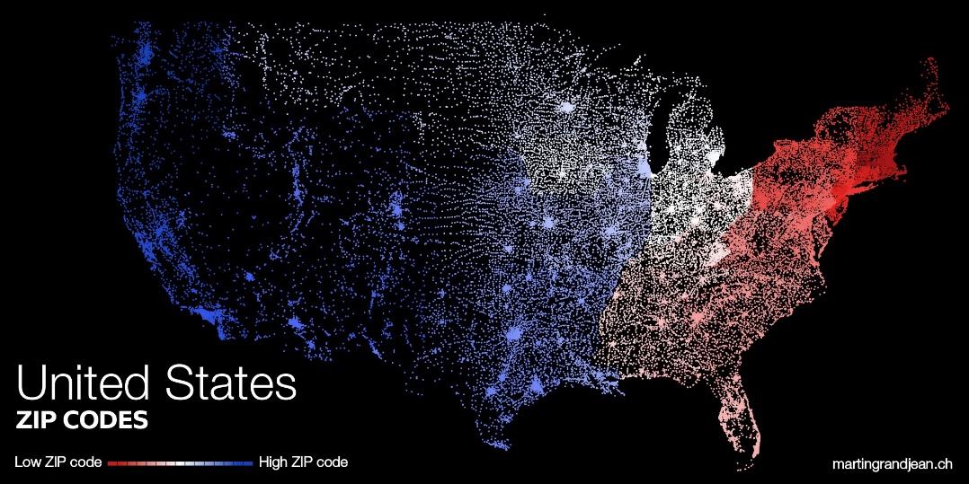
The chart above provides how postal codes of the United States differ by regions. The low numbers are colored in red. The high numbers are colored in blue. This visualization clearly shows that most of the high number codes are in the west, and the most of the low number codes are in the east. This visual analysis provided us a picture of how the different postal codes in the United States are organized.